How Canadian cities are rethinking their relationship with green space
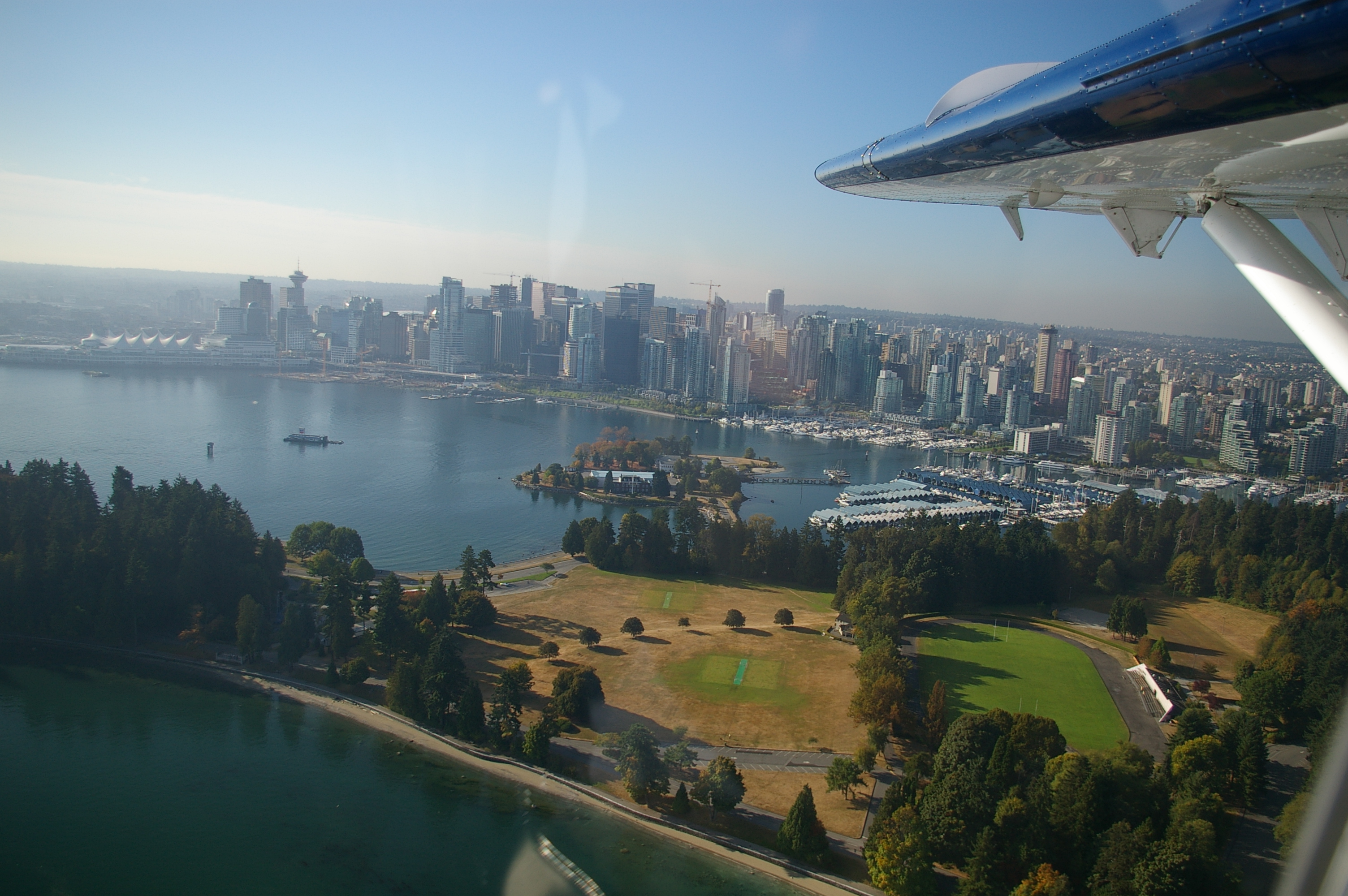
From Vancouver's forest buffers to Ottawa's riverfront parks, municipal park planning in Canada has moved well beyond benches and lawns. This site tracks the policies, design standards, and ecological thinking shaping public green space across the country.
Green corridors aren't decoration — they're municipal infrastructure
In cities like Calgary and Halifax, planners now treat connected park networks as essential as road grids. Ecological corridors move water, support pollinators, reduce flood risk, and lower urban heat island temperatures by 3–5°C in dense neighbourhoods.
Read the corridor analysisIn-depth coverage of park planning across Canada
Each piece draws on municipal reports, academic research, and publicly available planning documents from Canadian cities.

Green Corridors in Canadian Cities: Design, Policy, and Ecological Function
How connected green infrastructure networks are being built into municipal official plans from Victoria to Halifax.

Urban Forestry and Tree Canopy Management in Canadian Municipalities
A look at how Toronto, Edmonton, and Montreal are measuring, protecting, and expanding their urban tree cover.

Public Park Design Principles Applied Across Canada
From inclusive playgrounds to naturalized stormwater gardens: how design standards shape Canadian park experiences.
Urban forestry is measured, not assumed
Canadian municipalities are moving to LiDAR-based canopy mapping and species-level inventories. Toronto's tree canopy report tracks 10.2 million trees across 631,000 properties. Edmonton's Forestry Branch manages roughly 400,000 trees on public land alone — each tagged, assessed, and scheduled for maintenance cycles.
Canopy management explainedAreas covered on this site
The material here focuses on documented, publicly available information about Canadian urban park and green space planning.

Riverside & Urban Parks
Ottawa's Major's Hill Park and similar riverfront spaces show how topography and history shape park form in Canadian capitals.

Community Green Space
Street-level green infrastructure — from boulevard gardens to pocket parks — is increasingly formalized in BC municipal bylaws.

National Urban Parks
Rouge National Urban Park in Toronto remains Canada's first and only national urban park — a 79 km² ecological reserve within city limits.
The 40% canopy target and what it actually requires
Several Canadian cities have adopted informal targets of 40% tree canopy coverage in residential areas by 2050. Reaching that figure from current levels of 17–22% in most cities demands coordinated planting programs, species diversification, and protection of existing mature trees — not just new planting.
Read full analysisGreen space data and park planning documentation across Canadian municipalities
Park design standardsGet in touch
For editorial questions, corrections, or research inquiries, use the form below.